Acknowledging the Bindal and Wulgurukaba people as the Traditional Owners and first people to live in the Townsville Region for thousands of years and many generations.
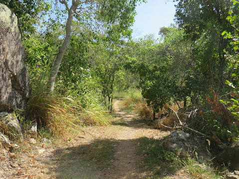
Mount Louisa Bush Walking Track is popular amongst fitness enthusiasts, providing a great opportunity to get fit outdoors. Located 11km north of Townsville's CBD, the track starts from suburban Weston Street, Mount Louisa.
The 3.5km circuit track contains many stair climbs along the way to reach the summit and enjoy sweeping views to the north-east across Townsville and Cleveland Bay out to Magnetic Island, as well as views from the ridgeline and summit extending south-west from Mount Stuart to Kirwan.
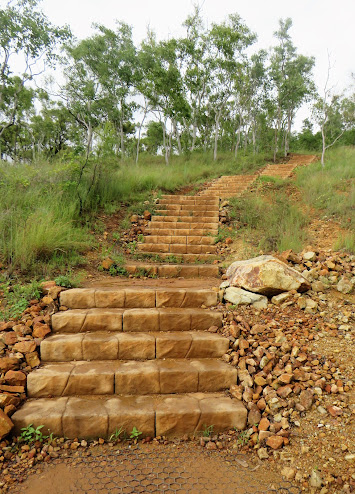
About 100m from the start of the track, you come to the first set of steps.
Now you get a good idea of what you have signed up for.
This is a Class 3 walking track containing steep grades, loose surfaces, uneven steps and minimal infrastructure. The walk provides a good workout and rewarding hill summit experience.
About 1km along the trail you have a choice to make...
Take the 650m stair climb to the summit, a short cut with high intensity,
or
Continue up the trail for 1.7km, almost 3 times the distance to reach the top, still huffing & puffing from stair climbs along the way, but more gradual paths making it less physically intense.
The track officially opened in October 2020 after a $2.2M investment from Townsville City Council. The trail was designed in consultation with a local track expert, Peter McLean, built by JMAC Constructions and incorporates stone steps supplied by Edenstone Masonry NQ. (1) According to interpretive signs along the track, the Bindal and Wulgurukaba people, as traditional owners, named the area Goo-bal-a-boro and Moor-ee-roon. The European name of Mount Louisa was given in 1864 by local explorer Andrew Ball, after a lady of his acquaintance, although nothing else is known about the lady.


Seating and interesting interpretive signage along the way.
Interpretive signage tells the stories of this area over recent history. Mount Louisa wasused during WWII as an extension to the aerodrome located in neighbouring Garbutt, and as a station for US defence forces. In 1959, the land was purchased by the Fairbrother family for a pig farm.
There is a total of 1,700 steps along the trail.
Excellent views across suburban Mount Louisa, neighbouring Garbutt,
across to Cape Pallarenda, Cleveland Bay and Magnetic Island
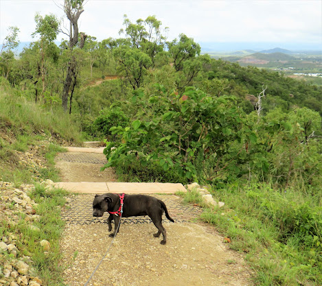
Dogs on leads are permitted
Rainbow Bee-Eaters are found throughout mainland Australia, southern birds will fly north for winter. They eat mainly bees and wasps, as well as butterflies, moths, dragonflies and beetles. When they catch a bee or wasp, the Rainbow Bee-Eater will carry it's catch back to a perch and rub it against the perch to remove the stings and venom before eating it. These birds build nesting tunnels in sandy banks and line their tunnel with grass. (2)
Reaching the summit of Mount Louisa Bush Walking Track is an achievement
with 360 degree views as the reward.
References:
1. Townsville City Council, Media Release, 2 October 2020
https://www.townsville.qld.gov.au/about-council/news-and-publications/media-releases/2020/october/on-your-marks-get-set-go-new-mount-louisa-walking-trail-to-open
2. Birdlife Australia
https://www.birdlife.org.au/bird-profile/rainbow-bee-eater
.JPG)


.JPG)


.JPG)
.JPG)
.JPG)
.JPG)
.JPG)
.JPG)

.JPG)

.JPG)
.JPG)
.JPG)


.JPG)


.JPG)
.JPG)
.JPG)
.jpg)

.jpg)
.JPG)
.JPG)
.JPG)
.JPG)


.JPG)


.JPG)
.jpg)

